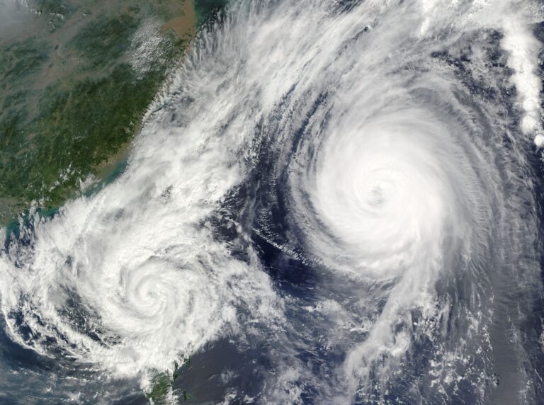
Experts always tell us to prepare for the worst as we head into hurricane season. This year, that could be taken literally, as the National Oceanic and Atmospheric Administration is forecasting more named storms than it has ever done before.
The NOAA expects between 17 and 25 named storms, of which eight to 13 are expected to be hurricanes and four to seven “major hurricanes” with winds of 111mph or higher.
The Colorado State University’s esteemed meteorological team supports NOAA’s expectation for a busy hurricane season. CSU calls for 23 named storms to form in the Atlantic, 11 of which are likely to become hurricanes and five major hurricanes.
Adding historical perspective, the CSU team’s forecast is for 2024 activity levels will be about 170 per cent of the average season over the three decades from 1991 to 2020. For comparison, 2023 was around 120 per cent.
Meteorologists highlight two main factors behind the extraordinary storm activity expectations.
Ocean temperatures
Most hurricanes form in a tract of ocean that stretches from West Africa to the Caribbean, known as the Main Development Region (MDR). Ocean heat is tropical cyclone fuel and this year, temperatures in the MDR have reached record highs.
In May, NOAA reported that “currently observed sea surface temperatures in the MDR and North Atlantic are similar to those normally observed in late July and early August”.
Temperatures in the Atlantic started to break records in March 2023 and have stayed extraordinarily high ever since. In April, NOAA observed “an area-averaged anomaly of +1.22°C”. During 2023, the comparable value was +0.46°C.
Ocean surface temperatures in the Atlantic Basin were at record highs for the time of year for an astonishing 421 consecutive days, a streak that ended in late April. Even scientists are baffled.
“I do not have any solid explanations for it,” Brian McNoldy, a senior researcher at the University of Miami in Florida, told news website Axios in April when asked about the record high temperatures. “I would say that I’m just a shocked observer like so many others. It’s not just that the global-average sea surface temperature has been record-breaking every single day… but it’s the absurdly-large margins by which the records have been broken.”
Explaining how this worrying warming sea phenomenon points to more hurricane activity this year, CSU states: “When waters in the eastern and central tropical and subtropical Atlantic are much warmer than normal in the spring, it tends to force a weaker subtropical high and associated weaker winds blowing across the tropical Atlantic.
“These conditions will likely lead to a continuation of well above-average water temperatures in the tropical Atlantic for the peak of the 2024 Atlantic hurricane season. A very warm Atlantic favours an above-average season, since a hurricane’s fuel source is warm ocean water. In addition, a warm Atlantic leads to lower atmospheric pressure and a more unstable atmosphere. Both conditions favour hurricanes.”
In its April forecast, CSU estimated a 66 per cent chance of a major hurricane making landfall in the Caribbean this year, compared to the average of 47 per cent between 1880 and 2020, with the numbers for the US 62 per cent and 43 per cent respectively.
La Niña
The El Niño Southern Oscillation is a natural phenomenon whereby the state of winds and currents in the Pacific influence weather around the world. Forecasters expect the oscillation to enter its La Niña phase by the peak of hurricane season, in August to October.
That is a supporting factor for hurricane activity as La Niña tends to decrease wind shear in the tropical Atlantic, creating better conditions for storms grow in intensity.
Alex DaSilva, AccuWeather’s lead hurricane forecaster, explained in an AccuWeather online article how wind shear can hamper the formation of hurricanes. “It can be helpful to visualise a stack of pancakes,” Mr DaSilva explained. “A tall, neat stack is what a tropical system wants to be, but wind shear can cause some pancakes to be displaced and the stack could fall over.”
It follows that if La Niña moves in and reduces wind shear, major hurricanes will have a higher chance of forming.
While forecasters cannot be certain of La Niña conditions, NOAA estimates a 77 per cent chance of this occurring, with a smaller probability (22 per cent) for “ENSO-neutral”. However, there is little encouragement to be drawn from that, as NOAA points out: “ENSO-neutral is typically associated with above-average levels of activity.”
The oft-expressed view among many older residents of Bermuda that “we seem to get more hurricanes than we used to” is backed up by scientific observation of an ongoing upward trend.
“The set of conditions that have produced the ongoing high-activity era for Atlantic hurricanes which began in 1995 are likely to continue in 2024,” NOAA points out.
“These conditions include warmer sea-surface temperatures and weaker trade winds in the Atlantic hurricane Main Development Region, along with weaker vertical wind shear, and an enhanced West African monsoon.”
The message for Bermuda could not be clearer: be prepared!

