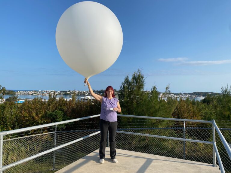
by Tim Smith
Michelle Pitcher had been sitting on the forecasting desk at Bermuda Weather Service (BWS) one weekend in 2014 when a subtropical depression named Fay was forecast to brush within 100 miles of the island.
That system evolved into a tropical storm heading straight for the island throughout the Saturday—and its erratic and destructive nature made it a storm Pitcher will never forget. “I went to bed Saturday night expecting the eye of Fay to pass while I was asleep,” says Pitcher, the deputy director at the BWS. “Getting ready for work the next morning, I thought it was awfully quiet outside as I expected stronger winds to be around as Fay exited our area.”
Like thousands of other people, Pitcher woke to find scenes of utter destruction. “There were branches and other debris in the roads, so it was obvious that we had experienced tropical storm-force winds,” she says. “When I arrived at work, I found out that the eye of Fay was actually over the island, hence the light winds and, once the back edge of the eye came into view on the radar, I saw that we would be in for some severe weather.”
Pitcher relays what happened next. “I alerted key stakeholders that severe weather was imminent and myself and the duty meteorological technician did our best to keep up with the rapidly changing conditions over the next couple of hours.”
Luckily the worst of it didn’t last more than an hour and conditions steadily settled through the rest of that day. Anyone who remembers the infamous double-hurricane hit of 2014 might guess what happened next.
“There was no rest for the weary, as Hurricane Gonzalo was hot on the heels of Fay,” Pitcher recalls. “The rest of my shift run was spent gearing up for the arrival of Gonzalo.”
Fay was later upgraded to a Category 1 hurricane following reanalysis by the National Hurricane Centre (NHC) , while Gonzalo was a Category 2, making it one of Bermuda’s worst hurricane seasons in living memory.
Pitcher shares her memories of that week as she discusses how the BWS team keeps us up to date with the latest news every time Bermuda comes under threat from a major storm. She works alongside director Mark Guishard, five meteorological technicians and a climate data and systems administrator. During a major storm, those on duty launch weather balloons to collect key data, communicate with colleagues at the NHC and release regular forecasts and warnings through the BWS website, on Facebook, through media interviews and on the Emergency Broadcast station (100.1FM). They also deal with briefing requests and Emergency Measures Organization meetings during the lead-up to the storm.
It’s a heavy workload with no chance to go home and relax. Pitcher explains: “As conditions are usually unsafe during shift-change times, several off-duty staff sleep at BWS to ensure that they are ready to take over when it is time for their shift.”
While hurricanes may be unpredictable, the cycle of the BWS team tends to follow a pattern.
“There are similarities and differences for each cyclone,” Pitcher says. “There are more staff around to start with as the extra workload is too much for one forecaster alone to keep up with. There is excitement in the lead-up to the arrival of the worst conditions as our forecasting skills are put to the test. Remember that we love weather and experiencing such a powerful phenomenon first-hand and to see how our challenging forecasts compare to reality is a privilege.”
Pitcher says the shifts go by quickly, with much discussion on details amongst those at BWS as well as with NHC specialists. “During the height of a hurricane’s passage, there is usually a pause in activity just to silently appreciate the power of the cyclone as well as to watch our many instruments’ readouts,” she says. “At this point our drop ceiling tiles are usually rattling and there are unusual noises as the winds try to get in under the storm shutters or any small cracks or holes. We don’t have time to pause for long as we continue to monitor and issue updates.”
When the eye of a hurricane is expected to pass overhead, the team releases a weather balloon to capture key details. “This valuable data from the eye of a hurricane is essential to tropical cyclone research,” Pitcher explains. “The more that is understood about these cyclones, the better they can be forecast. The BWS has had this unusual privilege of the eye of a cyclone passing over us a few times in recent years.”
The BWS team gathers its weather information via computer models, remote sensing, internet data and from the NHC specialists, who have access to cyclone data. Pitcher says: “Technology has improved in that much more data is available now than ever before. It’s almost too much to analyze in a timely manner now.”
This data has enabled the NHC to improve its intensity and track forecasts and enabled BWS to increase the accuracy of our forecasts. “Tropical cyclones remain one of the most difficult weather features to predict. The increase in available data and remote sensing allows everyone to better understand them, predict their movement and intensity and be able to give an earlier warning if conditions start to change significantly from previous forecasts.”
Forecasting technology will continue to evolve. “Faster supercomputers that can handle more data will allow models to be more precise as resolutions get smaller,” Pitcher says. “Improved technology increases the accuracy and amount of real-time data being gathered.”
This helps researchers and analysts gain a better understanding of how the atmosphere works.
“As forecasting improves, so does our ability to predict and warn people of adverse conditions and allow for preparations to take place in the interest of protecting lives, property and livelihoods,” she says.

